13 Colony Map Worksheets
- 41 pages
- 6th, 7th, 8th
$2.50 $5.00 on Teachers Pay Teachers
Half the Teachers Pay Teachers price. The same PDF, sold direct.
DownloadOr get it with All-Access: pick any 20 resources a month for $7.
New here? Your first month of All-Access is half off with code TEACHERTOK
Already bought this, or a member?
Instant download. One teacher's license: colleagues need their own copy. Each file carries a license number.
Also on Teachers Pay Teachers: see the Bright Path Sped store
About this resource
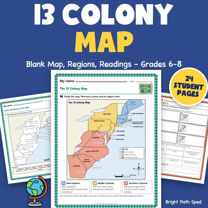
Teaching the 13 colony map and need pages students can actually label and use? This is a complete set for grades 6-8 built around one clear map of the thirteen colonies, drawn for this file: color-coded by region with a map key, a compass rose and a scale bar. Students study the labeled map, then label the colonies on a numbered blank map and write the names right on a second blank map. Then they use it: name the parts of a map, find landforms and water, give compass directions, find cities, read latitude and longitude on a grid and measure distance with a mile ruler. Three short readings (New England, Middle and Southern Colonies) each sit beside a map with that region colored. A regions sort, color-the-regions, a regions organizer, three cut-and-paste mats, short answers, a claim-evidence-reasoning page and a two-part quiz finish the unit. Answer keys give every answer, and the numbered map in the key shows the finished labels.
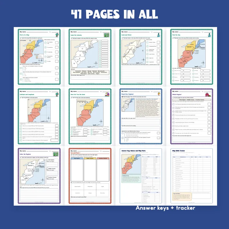
EVERYTHING INSIDE (41 pages)
- 24 student pages in 17 kinds of page, each with a name line and one short instruction
- 123 scored items spread over 17 scored pages, every direction, distance and coordinate worked out from the same points that draw the map
- 1 labeled study map (13 colonies, 3 region colors, 7 city dots, a map key, a compass rose, a scale bar and the Appalachian Mountains)
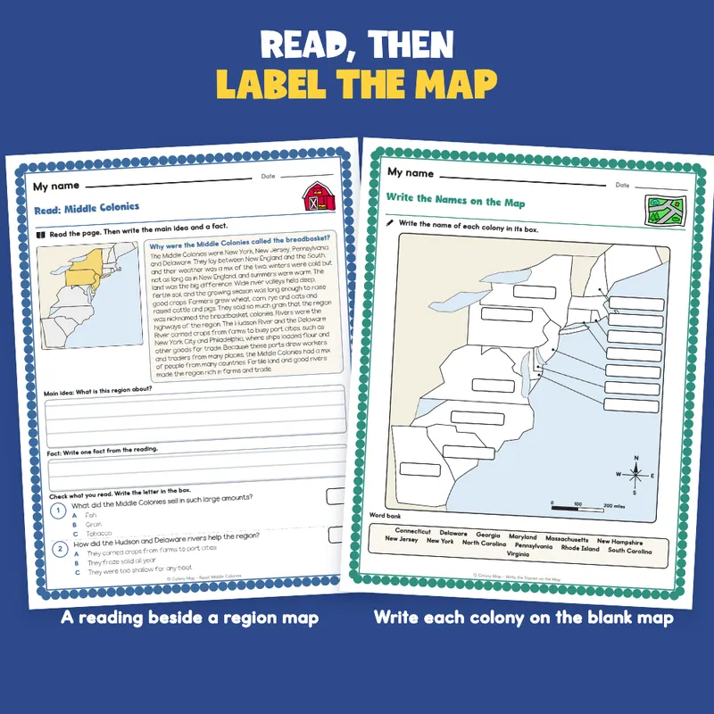
- 2 label-the-colonies pages: a numbered blank map with a 13-name word bank, then a blank map with 13 write-in boxes (7 small colonies get a box in the Atlantic with a line to the colony)
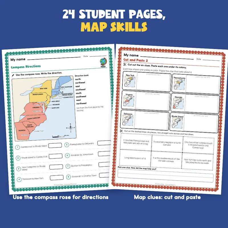
- 6 map-skills pages: parts of a map (8 items), land and water (6 lettered features), compass directions (8 pairs), find the city (8 cities, letter and colony), latitude and longitude on a 5-degree grid (6 items), and how far (6 distances with a mile ruler drawn at the map's own scale)
- 3 readings of 161 to 164 words, one per region, each beside a map with that region colored, with a main idea box (3 ruled lines), a fact box (2 ruled lines) and 2 checks (6 checks in all)
- 1 Which Region? sort (9 facts), 1 Color the Regions page (list the colonies in each region), 1 Compare the Regions organizer (land and climate, jobs, a river or port)
- 3 cut-and-paste mats, 6 pieces each in a 3 by 2 grid (18 pieces): colonies to regions, facts to regions, and map clues (six colonies shown in color on small maps)
- 6 short-answer questions across two pages (at least 4 ruled lines each), 1 claim-evidence-reasoning page, a 14-item quiz in two parts (the second part is a numbered map), 1 self check (8 statements)
- 4 answer keys; 1 tracker, 1 class grid, 1 team note, 1 family page
- 1 filled example (an invented student), 1 phrase bank (17 starters in 6 groups)
- A binder cover with type-in teacher and class fields, and a page of divider tabs (Maps, Readings, Cut and Paste, Quiz, Keys) with a spine label to cut out
- Start Here and a how-to-read-a-page page
Built For The Student Holding The Page
A "My name" line, one short instruction with a small picture cue, a plain scalloped border and big ruled and answer boxes. Nothing on a student page is written for an adult: the keys and records are on separate teacher pages. The cut pages have six pieces in a strip-and-grid layout, edge to edge, so there are only a few straight cuts. The map is drawn in light colors on a plain background and prints clean in black and white. Clip art is kept to a map, a globe, an anchor, a boat, a barn and a fish; the map itself is drawn for this file.
A Short Account, Not A Full Textbook
Type In, Or Print
The name line, every answer box, every check box, every ruled work box and the write-in boxes on the map are type-in fields in any PDF reader: click one, type, then save. The color and cut pages are for a pencil and scissors: they print. Print at 100 percent so the mile ruler stays true to the map beside it. This is a fillable PDF; it is not a Google Slides or PowerPoint file.
What This Is, And What It Is Not
A set of 13 colony map pages and readings with the record-keeping around it. It is not a timed test, a screener, a clinical tool, or a claim about any student's age or rate of progress. There is no IEP goal language or eligibility wording anywhere in the file, and no claim of alignment to any standard.
If You Want More
Climate Zones Worksheets | Map, Sort, Compare, Write 6th-8th Grade; Lewis and Clark Worksheets | Sort, Match, Timeline 6th 7th 8th Grade; Articles of Confederation Worksheets | Sort, Match, Timeline 6th 7th 8th Grade.