Civil War Map Worksheets
- 42 pages
- 5th, 6th, 7th, 8th
$1.70 $3.40 on Teachers Pay Teachers
Half the Teachers Pay Teachers price. The same PDF, sold direct.
DownloadOr get it with All-Access: pick any 20 resources a month for $7.
New here? Your first month of All-Access is half off with code TEACHERTOK
Already bought this, or a member?
Instant download. One teacher's license: colleagues need their own copy. Each file carries a license number.
Also on Teachers Pay Teachers: see the Bright Path Sped store
About this resource
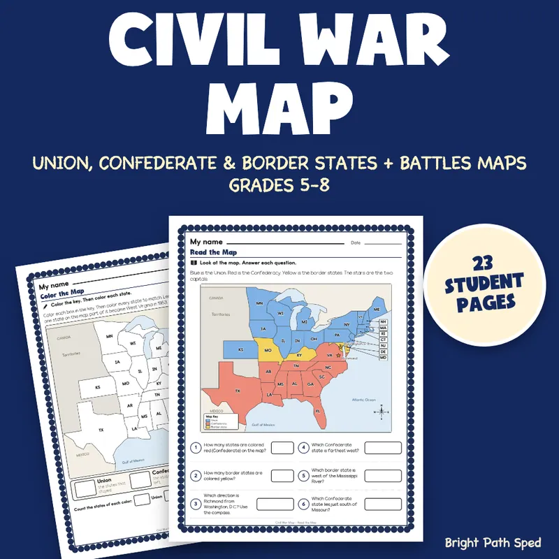
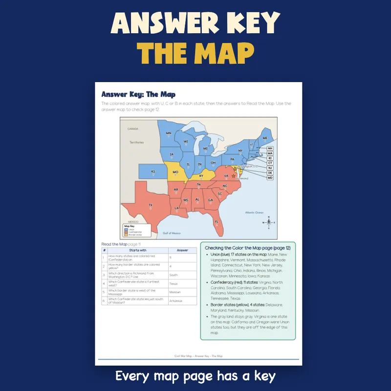
Teaching the Civil War and need a map your grades 5-8 students can actually work on? This packet gives them an original map of the eastern United States with the state lines of 1861. They read a colored map, color a blank map to show the Union, the Confederacy and the four border states (Delaware, Maryland, Kentucky and Missouri), name numbered states from a bank, and find six key battles: Fort Sumter, Bull Run, Antietam, Gettysburg, Vicksburg and Appomattox. Four short readings, a timeline, a fact file, a compare page, short answers, a quiz and three cut-and-paste sorts go with it. Answer keys included, with a colored answer map.
EVERYTHING INSIDE (42 sheets)
- 23 student sheets in 13 kinds of sheet, each with a name line and one short instruction
- 110 scored items spread over 18 scored sheets, every answer taken from the same lists that print on the sheet
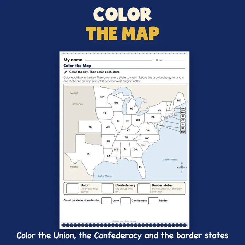
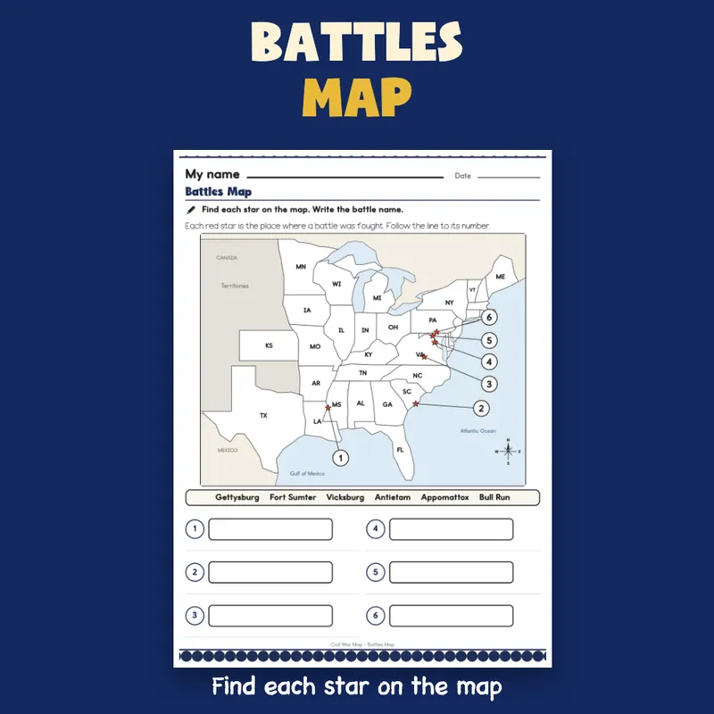
- 4 map sheets: Read the Map (a colored map with the two capitals marked and 6 questions), Color the Map (a blank map with a color key), Name the States (12 numbered states and a name bank) and Battles Map (6 starred places and a name bank)
- The map shows 32 states with their 1861 lines (17 Union, 11 Confederate and 4 border states) and one gray territories shape; Virginia is drawn whole, as it was in 1861
- 1 Which Side sheet: check Union, Confederate or Border for 12 states
- 4 readings of 97 to 126 words each (Two Sides; The Border States; Battles, Part 1; Battles, Part 2), each with a main idea box and 2 or 3 checks (11 checks in all); the last three also have a why-it-mattered box
- 1 timeline sheet: write the date for 6 battles from April 1861 to April 1865
- 1 fact file: 8 facts to fill in from a word bank
- 1 compare sheet: check Union, Both or Confederacy for 6 facts
- 1 Before and After Check (5 questions, an answer box for each time) and 1 Words to Know sheet: match 8 words (Union, Confederacy, border state, secede, capital, battle, siege, surrender) to their meanings
- 1 draw sheet with 4 panels, a drawing box and a line to write in each
- 6 short-answer questions across two sheets
- 12-item quiz across two sheets; 4 exit tickets
- 18 cut-and-paste pieces on 3 sort mats (states by side, battles by place, and six events in time order), 6 pieces each in a 3 by 2 grid
- 6 answer keys, including a colored answer map; 1 tracker, 1 class grid, 1 team note, 1 family page
- 1 filled example (an invented student), 1 phrase bank (17 starters in 6 groups)
- A binder cover with type-in teacher and class fields, and a sheet of divider tabs with a spine label to cut out
- Start Here and a how-to-read-a-sheet page
Built For The Student Holding The Sheet
A "My name" line, one short instruction with a small picture cue, a plain border and big ruled boxes. The map sheets use big two-letter state names, bold lines and a printed key. Nothing on a student sheet is written for an adult: the keys and records are on separate teacher sheets. The cut sheets have six pieces in a strip-and-grid layout, edge to edge, so there are only a few straight cuts. The map is drawn for this file from longitude and latitude points, so it is simplified rather than a survey map. There are no photographs. The file prints clean in black and white.
A Short Account, Not A Full History
Each reading is a plain-words summary written for this file, with no quotation of any kind. It keeps to a few well-known facts: eleven Southern states left the Union in 1861 and formed the Confederacy (South Carolina, Mississippi, Florida, Alabama, Georgia, Louisiana, Texas, Virginia, Arkansas, Tennessee and North Carolina); four slave states stayed in the Union and are called the border states; the capitals were Washington, D.C., and Richmond, Virginia, about 100 miles apart; Confederate guns fired on Fort Sumter in April 1861; Bull Run (July 1861) was a Confederate win; Antietam (September 1862) was the bloodiest single day of the war; the Union won at Gettysburg (July 1 to 3, 1863); Vicksburg surrendered on July 4, 1863 after a long siege and the Union held the Mississippi River; General Lee surrendered to General Grant at Appomattox Court House in April 1865. Check them against your own textbook or article; they are not tied to any standard. The only student in the file is an invented example, and it says so.
Type In, Or Print
The name line, every answer box, every check box and every ruled work box are type-in fields in any PDF reader: click one, type, then save. The Color the Map sheet is meant for crayons or markers. This is a fillable PDF; it is not a Google Slides or PowerPoint file.
What This Is, And What It Is Not
A set of maps, readings, organizers and sorting sheets with the record-keeping around it. It is not a timed test, a screener, legal advice, or a claim about any student's age or rate of progress. There is no IEP goal language or eligibility wording anywhere in the file, and no claim of alignment to any standard. The open answers have no single right wording; the keys give a sample and what to look for.
If You Want More
Shays Rebellion Worksheets | Reading, Timeline, Comic Strip Grades 6-8; Jamestown Worksheets | Sort, Match, Timeline 6th 7th 8th Grade; Southern Colonies Worksheets | Reading, Map, Economy Sort, Quiz Grades 6-8.