Climate Zones Worksheets
- 28 pages
- 6th, 7th, 8th
$2.25 $4.50 on Teachers Pay Teachers
Half the Teachers Pay Teachers price. The same PDF, sold direct.
DownloadOr get it with All-Access: pick any 20 resources a month for $7.
New here? Your first month of All-Access is half off with code TEACHERTOK
Already bought this, or a member?
Instant download. One teacher's license: colleagues need their own copy. Each file carries a license number.
Also on Teachers Pay Teachers: see the Bright Path Sped store
About this resource
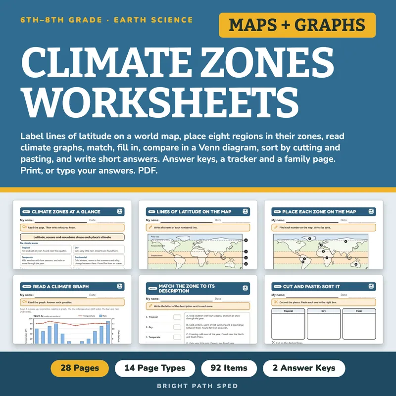
A complete climate zones kit for grades 6-8, built for the table where students need different amounts of support. Students read a one-page reference on six climate zones and what changes a climate, label the lines of latitude on a world map, place eight named regions in their zones, read climate graphs, match each zone to its description, fill in a paragraph from a word box, sort words into a Venn diagram, answer true-or-false, multiple-choice and circle-the-true-sentence questions, cut and paste features into tropical, dry or polar, and write short answers and explanations. Every student page has a name line, one short instruction and real room to write. Answer keys, a tracker, a class grid, a progress note and a family page are included, so nothing has to be written from scratch.
EVERYTHING INSIDE (28 pages)
- 14 student pages in 14 page types: Climate Zones at a Glance, Lines of Latitude on the Map, Place Each Zone on the Map, Read a Climate Graph, Match the Graph to the Zone, Match the Zone to Its Description, Fill In the Blanks, Compare in a Venn Diagram, Circle the True Sentence, Multiple Choice, True or False? Fix It, Cut and Paste Sort, Short Answers and Explain It
- 92 scored items on 13 pages, every answer read from the same lists that draw the pages
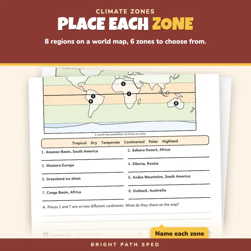
- 2 world-map pages drawn in code (simplified, not to scale): 5 numbered lines of latitude to name (equator, Tropic of Cancer, Tropic of Capricorn, Arctic Circle, Antarctic Circle) from a word box of 7, and 8 numbered regions to place in 1 of 6 zones
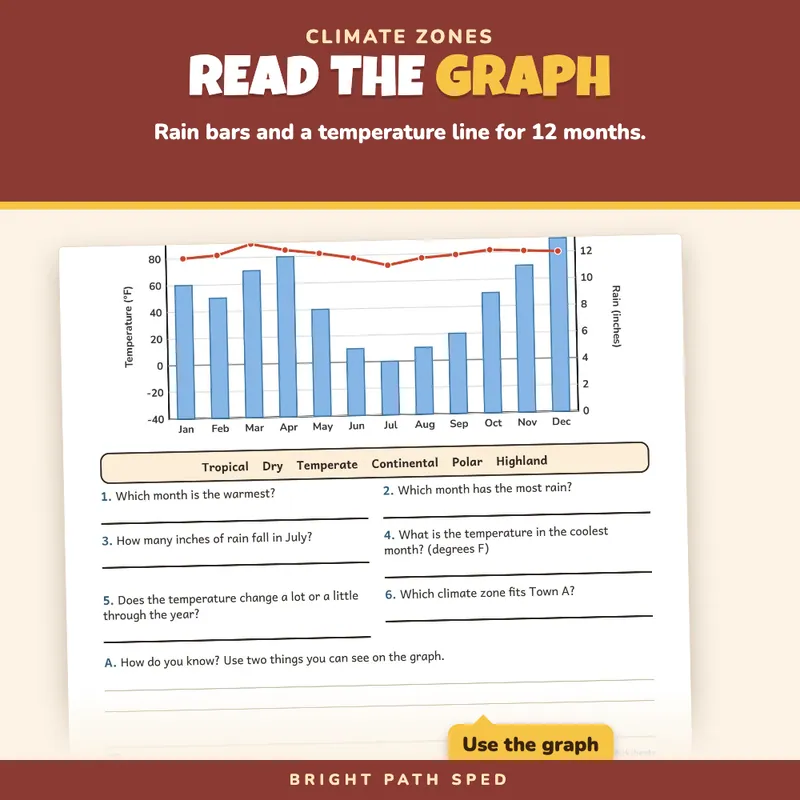
- 5 climate graphs drawn in code (rain as bars, temperature as a line, 12 months, the same scales on every graph), all for made-up towns: 1 large graph with 6 questions, and 4 smaller graphs to match to a zone, plus a question about which town changes the most
- 6 zones (tropical, dry, temperate, continental, polar, highland) matched to 6 lettered descriptions
- 10 blanks in a paragraph, from a word box of 12 (two are not used)
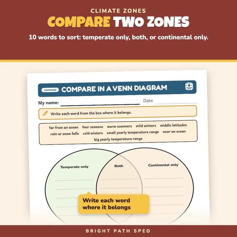
- 1 Venn diagram (temperate only, both, continental only) with a word box of 10
- 6 pairs of sentences where the student circles the true one, 8 multiple-choice questions and 8 true-or-false statements (with a line to fix each false one)
- 12 cut-and-paste pieces on one three-box sort mat (tropical, dry, polar), edge to edge, each piece 1.75 in by 1.15 in
- 5 short-answer questions with 4 writing lines each, and 3 explanation prompts with 5 or 6 writing lines each
- 2 answer keys, checked against the questions
- 1 tracker (page, page type, items right, date) and 1 whole-class progress grid
- 1 progress note (a hand-off page between team meetings) and 1 family page
- 1 filled example (an invented student, Maya R.), 1 phrase bank (15 starters in 5 groups), 1 binder cover and 6 divider tabs with a spine label to cut out
- Start Here page with a "which page, when" chooser
The Page Types
1. Climate Zones at a Glance: the 6 zones, 3 things that change a climate (latitude, oceans, mountains), and lines to write what the student knows.
2. Lines of Latitude on the Map: a world map with 5 numbered lines, a word box, and two questions with writing lines.
3. Place Each Zone on the Map: 8 numbered regions on the map, a word box of 6 zones, and a question about two regions.
4. Read a Climate Graph: one graph, 6 questions to answer from it, and a written question.
5. Match the Graph to the Zone: 4 small graphs, a zone and a clue for each, and one question about which town changes the most.
6. Match the Zone to Its Description: 6 zones, 6 lettered descriptions, and a written question.
7. Fill In the Blanks: a paragraph with 10 numbered blanks, a question about one word the student used, and the two words that were not needed.
8. Compare in a Venn Diagram: sort 10 words into temperate only, both or continental only, then write one sentence about how the zones differ.
9. Circle the True Sentence: 6 pairs, circle the true one and write its letter.
10. Multiple Choice: 8 questions with four lettered choices each. The right letter moves from question to question.
11. True or False? Fix It: 8 statements, a T or F box, and a line to rewrite each false one.
12. Cut and Paste: Sort It: 12 pieces to sort into tropical, dry or polar, then a written question about why two places at the same latitude can differ.
13. Short Answers: 5 recall questions with 4 lines each.
14. Explain It: 3 prompts (why the equator is warmer than the poles, why a coast can have milder winters, why a high town at the equator is cool) with 5 or 6 lines each and sentence starters.
How To Use It
Hand out the reference page first, then any page in any order. Use it as a unit, as stations, as a quick check or one page a day. The Start Here page maps what you want to do (introduce, map, graph, compare, check, write) to the page to use.
Built For The Student Holding The Page
A big "My name" line, one short instruction, body text at 11 point or larger, answer boxes you can type in or write in, and writing lines at a size that fits middle school handwriting. There are no cartoon characters or baby-ish borders. Nothing on a student page is written for an adult; the keys, tracker and notes are on separate teacher pages. The file prints clean in black and white.
No Guessing The Answer
Wherever a student picks among printed spots (the lettered choices, the order of true and false, the letters on the matching page, the order of the cut pieces) the position of the right answer is checked in code so it does not sit in the same spot three times in a row.
Type In, Or Print
The name line, every answer box, blank and writing line is a type-in field in any PDF reader: click one, type, then save. The same goes for the tracker, the class grid, the progress note and the family page. This is a fillable PDF; it is not a Google Slides or PowerPoint file. The cut-and-paste sort is for pencil, scissors and glue.
Who This Is For
Middle school science and social studies classes, resource rooms, co-taught classrooms and special education teachers who need a complete climate zones unit at grades 6-8 content with room for support: a word box, sentence starters and a reference page. It can be used as a unit, as stations, or one page a day.
What This Is, And What It Is Not
A climate zones worksheet set with the record-keeping around it. The science is the standard middle school textbook version, in plain words. The map is a simplified drawing, not to scale, and the graph numbers are made up for practice; neither is a real weather record. It is not a timed test, a screener, a clinical tool, or a claim about any student's age or rate of progress. There is no IEP goal language or eligibility wording anywhere in the file.