Topographic Maps Worksheets
- 45 pages
- 6th, 7th, 8th
$2.50 $5.00 on Teachers Pay Teachers
Half the Teachers Pay Teachers price. The same PDF, sold direct.
DownloadOr get it with All-Access: pick any 20 resources a month for $7.
New here? Your first month of All-Access is half off with code TEACHERTOK
Already bought this, or a member?
Instant download. One teacher's license: colleagues need their own copy. Each file carries a license number.
Also on Teachers Pay Teachers: see the Bright Path Sped store
About this resource
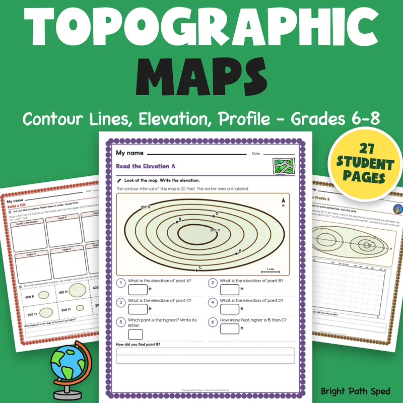
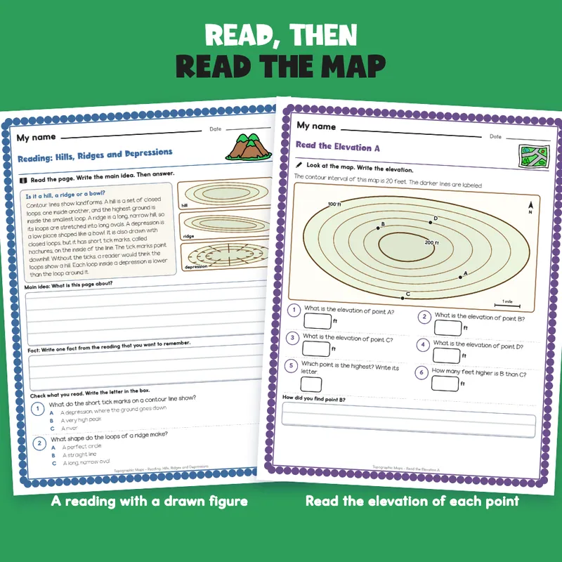
Teaching topographic maps and need pages students can actually work on? This is a complete set for grades 6-8: five short readings (contour lines, contour interval and index contours, steep and gentle slopes, hills, ridges and depressions, and profile view), each beside a drawn contour map, each with a main idea box, a fact box and two checks to answer with a letter. Then students sort small maps into hill, bowl or ridge, pick the steeper of two sets of lines, read the elevation of lettered points, count the spaces to find the contour interval, draw contour rings from a side view, plot a profile from a map, choose the gentler of two trails with claim, evidence and reasoning, take a two-part quiz and do three cut-and-paste mats, including a build-a-hill mat. Answer keys give every number, and the drawing and profile keys show the finished figures.
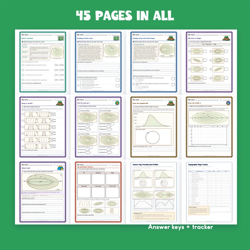
EVERYTHING INSIDE (45 pages)
- 27 student pages in thirteen kinds of page, each with a name line and one short instruction
- 115 scored items spread over twenty pages, every answer taken from the same numbers that draw the map
- 5 readings of 99 to 118 words, one per idea, each beside a drawn figure, with a main idea box (3 ruled lines), a fact box (2 ruled lines) and 2 checks (10 checks in all)
- 1 Before You Read page with 4 true-or-false items; 1 Words to Know page: match 8 words (elevation, contour line, contour interval, index contour, slope, depression, summit, profile) to their meanings
- 2 sorting pages: name the landform on each of 8 small maps (hill, bowl or ridge); pick the steeper map in each of 6 pairs
- 2 Read the Elevation pages (6 questions each): elevations on a labeled map, a point between two lines, the highest point, a difference in elevation, the steeper side
- 2 Find the Interval pages: 4 small maps each; count the spaces, find the contour interval, find the highest line
- 3 drawing pages: draw rings from a side view (a symmetric hill, then a lopsided hill) and draw your own island with contour lines and a bowl
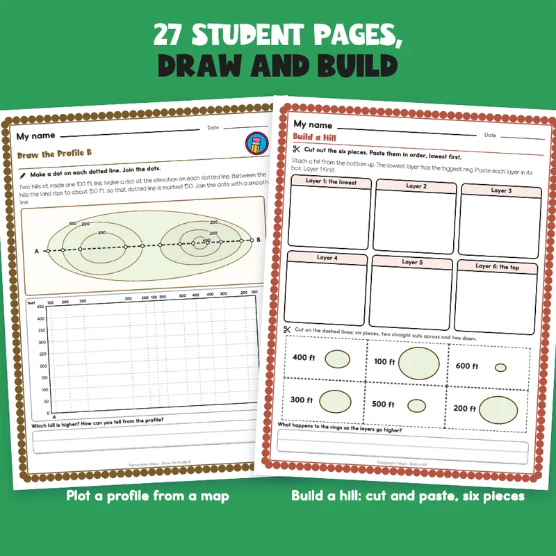
- 2 profile pages: a blank graph under a map, with dotted guides at every contour crossing (8 and 13 dots to plot)
- 6 short-answer questions across two pages, 4 ruled lines each; 1 trail-choice page with a claim, evidence and reasoning organizer
- 12-item quiz across two pages (the second part uses a labeled map); 1 self check (8 statements)
- 18 cut-and-paste pieces on 3 mats (build a hill from 6 layers, 6 maps of features, 6 word meanings), 6 pieces each in a 3 by 2 grid
- 5 answer keys; 1 tracker, 1 class grid, 1 team note, 1 family page
- 1 filled example (an invented student), 1 phrase bank (17 starters in 6 groups)
- A binder cover with type-in teacher and class fields, and a page of divider tabs (Readings, Reading Maps, Drawing, Quiz, Keys) with a spine label to cut out
- Start Here and a how-to-read-a-page page
Built For The Student Holding The Page
A "My name" line, one short instruction with a small picture cue, a plain scalloped border and big ruled boxes. Nothing on a student page is written for an adult: the keys and records are on separate teacher pages. The cut pages have six pieces in a strip-and-grid layout, edge to edge, so there are only a few straight cuts. Clip art is kept to a map, mountains, a globe, a tent, a ruler and a pencil; the contour maps and graphs are drawn for this file. The file prints clean in black and white.
A Short Account, Not A Full Textbook
Each reading is a plain-words summary written for this file, with textbook ideas such as contour lines joining points of equal elevation, index contours, close lines for steep slopes and tick marks for depressions. It does not quote any source and it is not tied to a particular standard. Check it against your own textbook, and pair it with a real topographic map if you have one. The only student in the file is an invented example, and it says so.
Type In, Or Print
The name line, every answer box, every check box and every ruled work box are type-in fields in any PDF reader: click one, type, then save. The two profile graphs and the island grid are for a pencil: they print, and the dotted lines show where to mark. This is a fillable PDF; it is not a Google Slides or PowerPoint file.
What This Is, And What It Is Not
A set of topographic map readings and practice pages with the record-keeping around it. It is not a timed test, a screener, a clinical tool, or a claim about any student's age or rate of progress. There is no IEP goal language or eligibility wording anywhere in the file, and no claim of alignment to any standard.
If You Want More
Climate Zones Worksheets | Map, Sort, Compare, Write 6th-8th Grade; Forms of Energy Worksheets | Sort, Match, Energy Chains, Write 6th-8th Grade; Gravity Worksheets | Mass vs Weight, Reading, Practice, Keys Grades 6-8.