13 Colonies Color by Number
- 19 pages
- 5th, 6th, 7th, 8th
$2.00 $4.00 on Teachers Pay Teachers
Half the Teachers Pay Teachers price. The same PDF, sold direct.
DownloadOr get it with All-Access: pick any 20 resources a month for $7.
New here? Your first month of All-Access is half off with code TEACHERTOK
Already bought this, or a member?
Instant download. One teacher's license: colleagues need their own copy. Each file carries a license number.
Also on Teachers Pay Teachers: see the Bright Path Sped store
About this resource
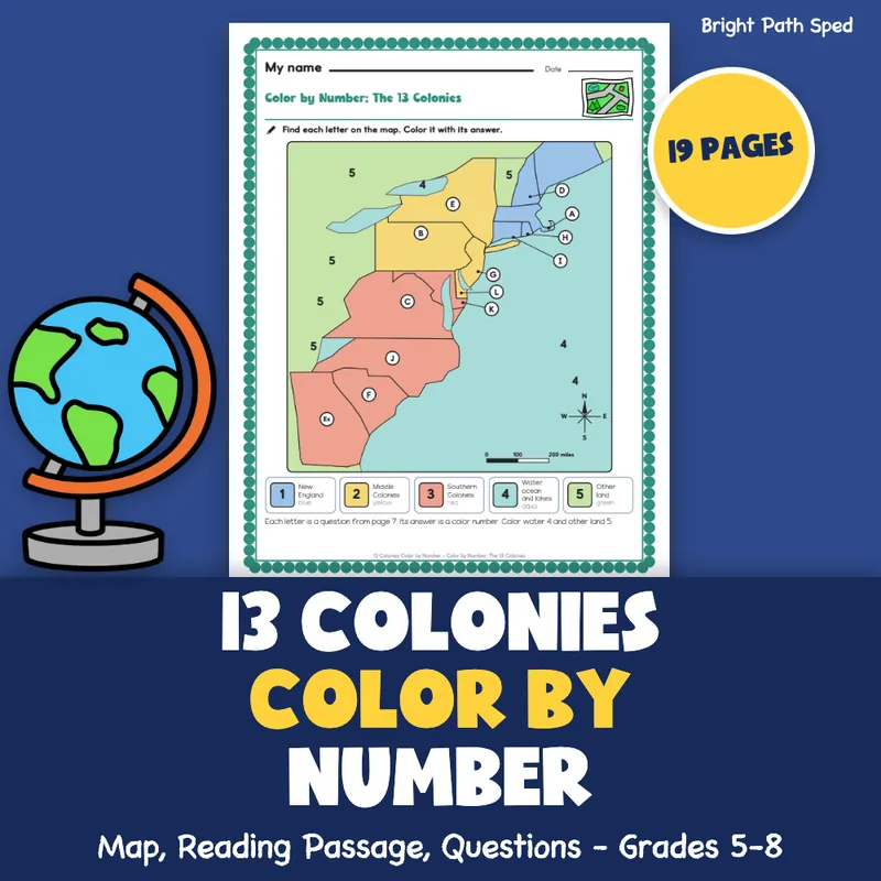
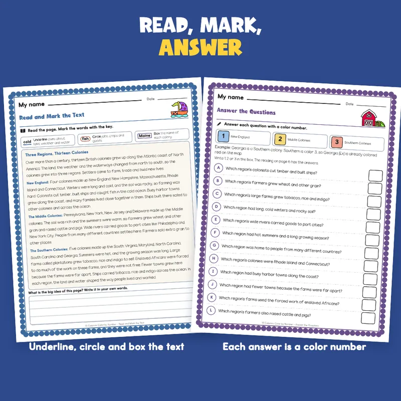
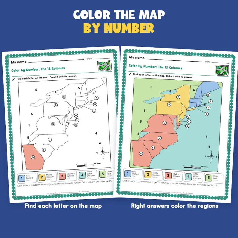
Looking for a 13 colonies color by number that makes students read first? Here the map is the picture, and the answers are the colors. Students read a 255-word passage about the three regions of the thirteen colonies, marking the text as they go: underline clues about land, weather and water, circle jobs, crops and goods, and box each colony's name. Then they answer 12 questions. Every answer is a color number (1 for New England, 2 for the Middle Colonies, 3 for the Southern Colonies), and every question has a letter that sits on one colony of a drawn map. Color each lettered colony with its answer, color the water 4 and the other land 5, and the finished map shows the three regions. Georgia is colored for them as the worked example.
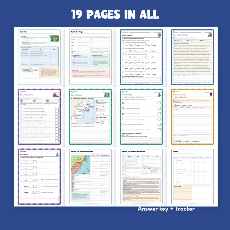
EVERYTHING INSIDE (19 pages)
- 8 student pages, each with a name line and one short instruction
- Before You Read: an anticipation guide with 6 sentences, agree or disagree before reading and again after
- Read and Mark the Text: a 255-word passage in four short paragraphs, with a marking key (underline, circle, box) and a ruled big-idea box
- Answer the Questions: 12 questions, one per lettered colony, each answered with a color number in an answer box
- Color by Number: a map of the 13 colonies to color, with a 5-color key (blue, yellow, red, aqua, green), a compass rose and a scale bar
- Color the Regions: a simpler map with every colony's name printed on it, three colored key squares and a box for how many colonies are in each region
- Check Your Map: counts of each color, the total (13), which color is on the most colonies and how many more than color 1
- Word Match: 6 words from the passage (timber, harbor, grain, port, plantation, enslaved) matched to their meanings, plus a sentence box
- Write About a Region: a paragraph page with sentence starters and a 3-item writing check
- 45 scored items across six student pages
- 2 answer keys: the colored map with each question's answer and the sentence in the passage that proves it, and a second key with the anticipation answers, the marked-up passage (5 underlines, 10 circles, 13 boxes), the word match, the map checks and a sample paragraph
- Start Here and a run-it page with plans for one sitting, two days, extra support, extra reach and a center folder
- 1 tracker, 1 class grid, 1 family page, 1 filled example (an invented student)
- What's next: the store's 13 Colony Map Worksheets and two more grades 6-8 social studies sets
Built For The Student Holding The Page
A "My name" line, one short instruction with a small picture cue, a plain scalloped border and big answer boxes. Nothing on a student page is written for an adult: the keys and records are on separate teacher pages. The map is drawn in black outline, so it prints clean in black and white; if you print without color, students write the color word in each colony instead of coloring. Clip art is kept to a map, a globe, a boat, a farm, an anchor and a pencil; the map itself is drawn for this file.
A Short Account, Not A Full Textbook
Type In, Or Print
The name line, every answer box, every check box, every ruled box and the tracker, class grid and family page are type-in fields in any PDF reader: click one, type, then save. The map is meant to be colored on paper, so print that page. This is a fillable PDF; it is not a Google Slides or PowerPoint file.
What This Is, And What It Is Not
A reading, text-marking and color-by-number set on the thirteen colonies, with the answer keys and record-keeping around it. It is not a timed test, a screener or a claim about any student's age or rate of progress, and there is no claim of alignment to any standard.
If You Want More
13 Colony Map Worksheets | Blank Map, Regions Sort, Readings Grades 6-8 pairs well: a labeled map, blank maps to label, map-skills pages and a reading for each region.